Traditional drone mapping produces a flat, two-dimensional map, whereas drone 3D scanning captures volumetric data, surface textures, and multi-angle spatial geometry to create a true digital twin.

“The drone didn’t just photograph the site — it preserved it, down to the centimeter, for future generations to study.” – field observation from a heritage documentation project
When most people think about commercial drones, mapping and surveying come to mind first. But over the past few years, the same core technology — high-resolution cameras, LiDAR sensors, and photogrammetry software — has quietly opened up two very different but closely related applications: precision 3D scanning and archaeological documentation.
Both fields depend on the same underlying idea: capturing a physical space so accurately that it can be studied, measured, and preserved digitally, long after the drone has landed.
KEY TAKEAWAYS
- Drone-based 3D scanning captures precise volume, surface texture, and exact spatial relationships, offering depth that flat, traditional maps cannot provide.
- Because archaeological excavation is an irreversible and destructive process, high-resolution aerial documentation provides an unalterable, permanent digital record for future study.
- Air-borne LiDAR sensors digitally strip away dense tree cover and surface canopy, exposing hidden ruins, ancient roads, and structures invisible to ground teams.
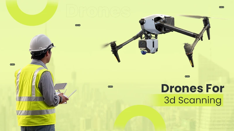
Traditional aerial mapping produces a two-dimensional view of a site — useful, but limited. Drone-based 3D scanning goes a step further. By flying a structured grid pattern and capturing overlapping images from multiple angles, modern drones can reconstruct a fully three-dimensional digital model of a building, structure, or terrain feature.
This isn’t just a nicer-looking output. A proper 3D scan captures volume, surface texture, and exact spatial relationships — data that a flat map simply can’t provide. Construction teams use it to track excavation volumes. Engineers use it to inspect structural wear that wouldn’t be visible from a straight-down photo. Property teams use it to document a site’s exact condition at a single point in time, which becomes critical if there’s ever a dispute later.
The accuracy involved is what makes this useful rather than just impressive. Depending on the sensor and flight altitude, centimeter-level precision is achievable, similar to the accuracy standards used in professional drone 3D scanning services, which are increasingly used across construction, real estate, and infrastructure inspection projects where a flat aerial photo simply isn’t enough.
Worth knowing: A single well-planned drone flight can capture the same level of detail that would previously have required days of manual measurement and a team of surveyors on the ground.
Archaeological sites present a unique documentation challenge. Excavations are, by nature, destructive — once a layer of soil is removed, that exact context can never be recreated. For decades, archaeologists relied on hand-drawn sketches, tape measures, and ground-level photography to record what a site looked like before and during excavation.
Drones have changed that equation significantly. A site that might take a survey team days to document by hand can now be captured from the air in a matter of hours, with a level of spatial accuracy that hand-measurement simply can’t match.
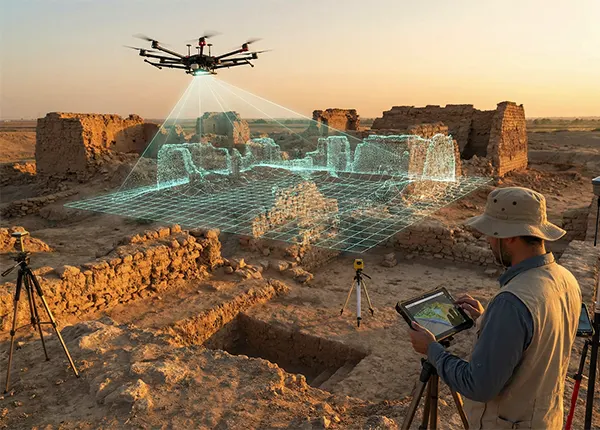
LiDAR-equipped drones bring an additional advantage: the ability to see through vegetation. Dense tree cover has historically hidden entire archaeological features from ground-based researchers — ruins, ancient roadways, and settlement patterns that only become visible once the LiDAR laser strips away the surface canopy digitally. This has led to genuinely significant discoveries in regions where dense forest previously made traditional surveying nearly impossible.
Beyond discovery, there’s the matter of preservation. A high-resolution 3D model created before excavation begins acts as a permanent digital record — one that researchers can revisit, measure, and study indefinitely, even after the physical site has been altered or lost to erosion, development, or time. This kind of aerial documentation work is becoming a standard part of how drone archaeology projects are approached, particularly for sites where the excavation process itself is irreversible.
3D scanning and archaeological documentation aren’t really two separate drone applications — they’re two expressions of the same underlying capability. Both rely on:
The equipment and workflow are largely identical. What changes is the objective — one is about tracking present-day change, the other about preserving a permanent record of something that’s about to change forever.
As drone hardware becomes more accessible and sensor quality continues to improve, this kind of precision documentation is no longer limited to large research institutions or government-funded projects. Smaller heritage organizations, universities, and even individual research teams are increasingly able to commission or conduct their own aerial 3D scanning work.
That shift matters. The more accessible this technology becomes, the more sites — construction, historical, or otherwise — get properly documented before they’re lost to time, weather, or development. What started as a mapping tool has quietly become one of the more meaningful applications of drone technology today.
Traditional drone mapping produces a flat, two-dimensional map, whereas drone 3D scanning captures volumetric data, surface textures, and multi-angle spatial geometry to create a true digital twin.
Drones equipped with LiDAR sensors emit laser pulses that slip through gaps in leaves and branches. The post-processing software filters out the vegetation returns, mapping the true topography of the ground below.
Centimeter-level accuracy ensures that construction engineers can reliably calculate exact material volumes and archaeologists can accurately map the precise spatial context of artifacts before they are moved.